Tuesday, June 2, 2015

From Mammoth to Tower Junction and on to the Lamar Valley

June 1:  Today our wanderings took us east from Mammoth Springs to Tower Junction.  The landscape includes hills such as these and many open valleys.

Our first stop was unplanned--bison in the road.  Here they are close to our car.  


The man in the car in front of us did what every sign in the park about animals says not to do: get yourself closer than 20 feet (unless you are in your car).  Bison are now considered the most dangerous animals in the park (more than grizzlies!) because people are immensely stupid around them.  Just yesterday a girl was gored in Mammoth Springs, so I was relieved when the man unharmed got back in his car as the bison came our way.


We stopped next to see the Undine Falls (named in the 1800s for water sprites from mythology) on Lava Creek. 


I also found these three types of flowers: bluebells, which I saw only in this spot, balsamroot, and alpine forget-me-not, both of which were widespread in this area.


At a stop along the road, I could see the meadows and hills:

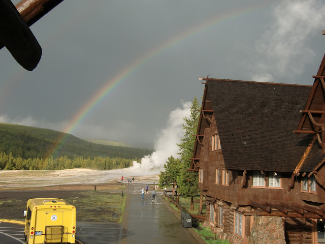
At the Forces of the North guided trail (created by the park with lots of signs to provide information), I caught these views.  


Also this flower which I saw several times today.  It is Prairiesmoke.  

This quaking aspen is surrounded by pines that died in fires and by new growth pines.  Fire is important for the renewal of the land in Yellowstone.


At this overlook, the small river in the distance is Hell Roaring Creek, which feeds into the same Yellowstone River that we saw when we first entered the park.  It flows north past the northern part of the park and into Montana.The second photo is a view slightly further along the valley.


While we didn't plan to do any hiking on this trip, walks in the woods were fine, and we found a short (1 mile) trail to and from Lost Lake.  I discovered some more flowers here including these two, which are sugar bowl (also called hairy clematis) and silky phacelia.


The walk in included this meadow:

When we got to the lake, I took this photo of Chuck.

Near where we had parked is the only petrified tree in the park.  There were two in 1912, but visitors took parts of it away til there was none left.  The remaining one is protected with fencing and signs warning not to touch.  It is believed the tree is a redwood, which is surprising for this area.


Once we reached Tower Junction (which has a gas station with some food), we got some lunch and headed further east into the Lamar Valley.  This valley has the most plentiful large animals in the park.  It is where the Lamar Buffalo Ranch (now the Yellowstone Institute) is located.   At the ranch starting the early 1900s, the remaining 40 buffalo (!) in Yellowstone were bred with ones from elsewhere in the country in an attempt to save buffalo in the park from extinction. The breeding program was very successful, as today there are about 4300 buffalo in the park, most of which winter in the Lamar Valley.  

The first animal we saw was the pronghorn, a kind of antelope and the second fastest animal in the world. Cheetahs are faster in a sprint, but pronghorns can keep running for distances at 30-40 mph!

We did enjoy stunning views, including one of the Lamar River.  


Close to the Yellowstone Institute is this meadow, where you can see large herds of buffalo in the distance, and this fellow closer up (he's not so close to me because I was using a telephoto lens!).


At the Institute, we turned around and went back the way we came from Mammoth Springs.  We enjoyed all the views again.  I look this view of the Terraces (white ridge in the center of the photo) as we approached the village.

And in the village across from our hotel was this lady elk.  There is a small herd that resides in the village to enjoy the lawns of planted grass (which are a holdover from when Mammoth Springs was a US calvary post---but more on that tomorrow!).

Along the road from Old Faithful Village to Mammoth Springs

On Sunday May 31 our destination was Mammoth Springs, at the northern edge of the Park.  It is the only part of the park with lodgings that are open year round, although in winter it is cold and snowy.  The distance we had to travel was 50 miles, which takes more than 2 hours given the roads if you don't stop anywhere.  We, of course, made lots of stops.

Before we left OF village, I did my morning walk.  I had the good fortune to walk past Castle Geyser as it was erupting (it only erupts about every 15 hours give or take several).  Unlike most other geysers we saw, it has a cone shape, and when it erupts the silica in the water condenses as hydrous silicon dioxide and adds to the cone. 


 The geyser erupted for about 25 minutes. I walked on after taking the first photos and came back for the last part of the eruption.

On our journey, our first stop was Excelsior Geyser, which does not erupt at this point in time, and looks just like a hot spring. Excelsior is still a geyser and not a pool because while it blew out the crater that caused its pressure chamber, it was a geyser less than a century ago. When the geyser did erupt, eruptions sometimes went 300 feet in the air.  


Now it puts out 4K gallons of water daily into the Firehole River (which runs from OF Village to Madison Junction and forms one of the sources for Madison river that runs west into Montana).  


Our next stop was another hot spot area along Firehole Lake Drive with this geyser, White Dome geyser.  There are many other pools and geysers along this drive, as well as Firehole Lake, but I stopped taking geyser photos!


Continuing on our way, the landscape is quite flat. 


It changes as the road nears Madison Junction and on a side road (Firehole Canyon Drive), the canyon formed along the river is quite visible.  


Further up the drive is Firehole Falls:


This photo shows the beginning of river cutting into the canyon, before the drop at Firehole Falls.

Along the road from Madison Jct to Norris, the road follows the Gibbons River. It also has a falls, which, while not the highest in the park, is quite wide and shows the river cutting a canyon into the terrain.

The view of the walkway above the falls:


As we drove north of Norris, the landscape flattened out, and in the meadows, there were plenty of bison, this one only feet from our car as we drove past.

A long section of the road was tough going, as the park service is widening the road with a big construction project.  Since it was Sunday, we didn't have to stop for construction work, but much of the road was down to bare dirt and slow, tricky driving.  My reward was that we were going slow enough for me to see lot of these lovely glacier lilies.


We went for a walk along the road to Indian Creek Campground, and the road follows the creek:

As we  got closer to Mammoth, the landscape changed again. This spot is called Golden Gate.

And here is Silver Gate where the boulders are evidence of glaciers long ago.

Just outside of Mammoth Springs are the Terraces, caused by the hot springs for which Mammouth is named.  The terraces are formed by hot water springs that bring hot water from deep in the earth through the limestone layer in this area.  The water mixes with the limestone, and when the hot water reaches the surface and cools, it precipitates out as calcium carbonate to form the many terraces.  Here are Jupiter Terrace, Mound Terrace and Minerva Terrace.


These next photos show village of Mammoth Springs from a distance, as well as closer up to our hotel, where we will stay for the next three nights, and the view out to the "village green".


The geysers and springs around Old Faithful geyser

Today's travels were all done on foot within a mile of Old Faithful.  We started out the day watching Old Faithful erupt from a different viewpoint.


In the field soaked with the acid water of the geyser were these lovely  Rocky Mountain fringed gentians:


The 2.3 mile loop around Old Faithful led us by many pools of hot water starting with this one.


Firehole River runs though the area and is charming to see.


The water from the pools and geysers flows into this creek, and as the orange sediment in this photo indicates, the water contains lots of minerals.


Here follows several of the hot pools we saw.  


In the mostly dried out earth around the pools, you can find these lovely birds (mountain blue bird, a kill deer and a chipping sparrow).


I saw many kinds of flowers including Indian paintbrush, white phlox and rosecrown:


Here's a view across the field towards the inn and OF:


It's not a very inviting landscape.  We were surprised by how much buffalo scat we saw in this area.  How the buffalo walk here without breaking through the thin crust near the geysers and pools is hard to imagine!  Us humans had to stay on the boardwalks laid out around the pools and geysers.

There are many other geysers in this area including this one.  Most don't erupt very often (on the order of days).  


However, the Grand Geyser is actually larger than Old Faithful.  Unlike OF, it only erupts once every 6 hours give or take 2 hours, so being in the right place is a matter of luck (or unbelieveable determination).  We had luck on our side.  We we sat on benches set out in front of the geyser and waited for about 10 minutes near the time it was predicted to erupt.  The first photo shows it as it begins to simmer and bubble.  


The second photo shows it fully erupting and also off to the left of the photo another geyser stream that started after the main one.


When we returned to Old Faithful Inn, I took these photos of the inside of the inn.  The upper part of the main hall, which goes 5 stories up even though the rooms of the inn are only on the first 3 floors looks like something from an Escher painting!  The second photo shows the main floor.


Just before dinner, there was a thunderstorm.  I caught this rainbow just at the end of it.